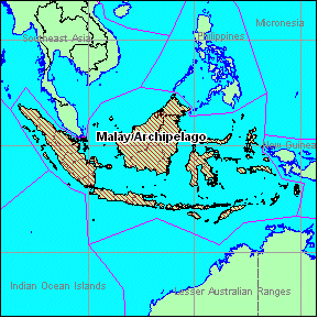
Malay Archipelago
| Range Type |
Archipelago |
| Highest Point |
Kinabalu
(4101 m/13,455 ft) |
| Countries |
Indonesia (87%), Malaysia (12%), East Timor (1%)
(numbers are
approxmiate percentage of range area) |
| Area |
1,698,470 sq km / 655,780 sq mi
Area may include lowland
areas |
| Extent |
2,031 km / 1,262 mi North-South
4,431 km / 2,753 mi
East-West |
| Center Lat/Long |
1° 25' N; 114° 3' E |
| Map Links |
MSN MapPoint Map
|
Links
Google
Search for Malay Archipelago
|

|
| Other Ranges: To go to pages for other ranges
either click on the map above, or on range names in the hierarchy
snapshot below, which show the parent, siblings, and children of the
Malay Archipelago. |
|
|
Major Peaks of the Malay Archipelago
| Ten Highest Peaks |
| Rank |
Peak Name |
m |
ft |
Range3 |
| 1. |
Kinabalu |
4101 |
13,455 |
Borneo |
| 2. |
Gunung
Kerinci |
3805 |
12,484 |
Sumatra |
| 3. |
Gunung
Rinjani |
3726 |
12,224 |
Nusa
Tengarra |
| 4. |
Gunung
Semeru |
3676 |
12,060 |
Java |
| 5. |
Bulu
Rantekombola |
3478 |
11,411 |
Sulawesi |
| 6. |
Gunung
Leuser |
3466 |
11,371 |
Sumatra |
| 7. |
Gunung
Slamet |
3428 |
11,247 |
Java |
| 8. |
Gunung
Arjuna |
3339 |
10,955 |
Java |
| 9. |
Gunung
Raung |
3332 |
10,932 |
Java |
| 10. |
Gunung
Sumbing |
3320 |
10,892 |
Java |
| Sub-peaks are excluded from this list. List may not be
complete, since only summits in the PBC Database are
included. |
Photos of Peaks in the Malay Archipelago
 |
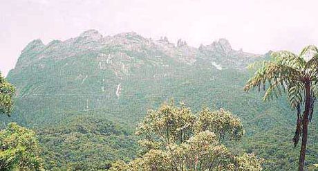
| Kinabalu:
The rocky towers of Kinabalu tower over the jungles of Borneo in
this view from the National Park headquarters. |
 |
| Gunung
Agung: A Balinese guide in front of the summit--he refused to go
any further, not wanting to tread on the summit of a holy
mountain. |
This page has been served 2632 times
since 2004-11-01.
Questions/Comments/Corrections? See the Contact
Page
Copyright © 2006 by Peakbagger.com. All Rights Reserved.
|

